Guiseley
West Yorkshire
Guiseley became established in Saxon times around a spring which still exists today as Guiseley Wells, although there is also evidence of some earlier settlement in the area,
The first church in Guiseley was built in the mid 12th century and the present St Oswald's Church traces its origins back to a rebuilding about a century later. There have been various extensions and alterations since then, not least its tower and porch from the 14th century.
Among the many weddings there over the years was that in December 1812 of the Rev Patrick Brontë and Maria Branwell, parents of the famous literary sisters.
Guiseley was for many years famous for Harry Ramsden's fish and chip shop. After early expansion to become the "world's largest" fish and chip shop, the business ran for more than 80 years before closing its original restaurant in 2011. A fish and chip shop and restaurant continues at the premises today after the Wetherby Whaler reopened the site a year later. Another famous fish and chip shop in Guiseley was that in Springfield Road, where Harry Corbett of glove puppet Sooty fame, grew up in the 1920s with his parents who then ran the shop.
 Town features
 Guiseley has a choice of pubs.
 The town has a range of shops and supermarkets and edge-of-town retail parks.
 The town has a Post Office.
 The town has a pharmacy.
 Guiseley has a bank.
 Takeaway food outlets in the town include fish and chips, chicken, chinese, curries, pizzas, burgers, sandwiches.
 The town has cafes and coffee shops.
 Restaurant dining can be found in Guiseley.
 The town has a leisure centre with swimming pool - Aireborough Leisure Centre.
 Guiseley has a theatre - Guiseley Theatre.
 The town has a park - Nunroyd Park.
 Guiseley has schools.
 Places of worship: Anglican, Methodist, Baptist, other.
 Travel
 Guiseley station
 Station Road
Station managed by: NORTHERN. Operator/s: NORTHERN.
 NATIONAL RAIL - Departure and station info
External link to National Rail live departure board for services at this station (opens in new tab).
Bus travel
The town has bus services to neighbouring towns and villages and city centres.  Road travel
Guiseley can be reached via the A65 A6038 B6153 Places to visit
Otley Chevin Country Park
The Otley Chevin Country Park is a forested hillside with rocky outcrops offering magnificent views across Otley and the Wharfe Valley, a network of paths to explore, a variety of wildlife and some interesting tree sculptures. The Chevin is an area with strong evidence of hunting in the stone age with thousands of flint arrowheads and knives having been found there. Cup and ring marked rocks dating from the bronze age are scheduled ancient monuments. Two areas of an iron age settlement were discovered in the 1960s and an archaelogical dig in the 1990s found evidence of a hut circle within a rubble enclosure. Much of the forestry in the area was planted in the 1950s and 1960s and it became a local nature reserve in 1989. There are car parks with access to the country park at East Chevin Road and Yorkgate.
Further information can be found at the
 Leeds City Council - Otley Chevin Country Park Friends of Chevin Forest
  Kirkstall Abbey
Abbey Road, KirkstallThe ruins of the Kirkstall Abbey, dating from 1152, are in public parkland alongside the River Aire at Kirkstall, 3 miles north-west of Leeds city centre. Cistercian monks occupied the building and owned surrounding land until the abbey was closed in 1539. While much of the abbey can be seen from the surrounding park, internal admission is available every day except Monday with tickets available on site. The Abbey also has a cafe. Buses from Leeds stop next to the abbey. The nearest railway stations are Headingley, just under a mile away, and Kirkstall Forge, just over a mile away.
More information at these
Leeds City Council - Kirkstall Abbey Find on map:
 Kirkstall Abbey
 Roundhay Park and Tropical World
Prince's Avenue, RoundhayRoundhay Park is a popular large park 3 miles north of Leeds city centre, owned by Leeds City Council, with more than 280 hectares of parkland, woodland, lakes and gardens. It also has cafes and is the location of Tropical World, which holds a large collection of tropical plants, birds and reptiles, a butterfly house, aquariums and other animal enclosures, including the ever-popular meerkats.
Find out more at this
Leeds City Council - Roundhay Park  Harewood House
HarewoodMore information can be found at the
Harewood website.Locate on map:
Harewood House  Nidderdale Area of Outstanding Natural Beauty
Extending across an area of 232 square miles (600 sq km), the Nidderdale Area of Outstanding Beauty starts at the edge of Otley . The area has a beautiful and varied landscape including rolling heather-topped moorland, stone-walled agricultural fields and farms, small villages, lake-like reservoirs and some outstanding geological features, the best known of which are Brimham Rocks. For more details see our Nidderdale page. Emergency services
West Yorkshire Police West Yorkshire Police West Yorkshire Fire and Rescue Service
West Yorkshire Fire and Rescue Service Yorkshire Ambulance Service NHS Trust
Yorkshire Ambulance Service NHS Trust  Local government
Metropolitan district council
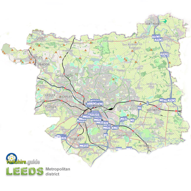 City of Leeds
The City of Leeds authority covers an area extending several miles beyond the city itself, including areas of agricutural land with widely spaced villages to the north east and several separate small towns including Garforth , Guiseley , Morley , Otley , Pudsey , Rothwell , Wetherby and Yeadon .
Leeds is just one of a ring five metropolitan councils covering the many cities, towns and villages of the conurbation of West Yorkshire. Around one-third of the West Yorkshire population live in the Leeds metropolitan district, just over ¾ million at the time of the 2011 census.
In the City of Leeds metropolitan district a total of 99 councillors are elected. There are three councillors per ward across 33 wards. Councillors are usually elected for four-year terms, one councillor being elected in each of three years out of four. A Lord Mayor of Leeds is elected from the council each year.
External link to Leeds City Council website.
Leeds City Council Political composition after May 2026 election:
99 members
Political composition after May 2023 election:
99 members
 See our Yorkshire.guide Gazetteer for more about the
  Leeds metropolitan district and places within it.
County strategic authority
West Yorkshire Combined AuthorityCovers some combined services of the five metropolitan district councils of
 Bradford ,
  Calderdale , Leeds ,
  Kirklees and
  Wakefield — which were at one time provided by a West Yorkshire metropolitan county council, with the addition of the non-contiguous unitary authority area of the City of
  York council as well as the unelected Leeds City Region Enterprise Partnership. Since 2021 it has operated with an elected mayor as chairman and decision-maker for some responsibilities. These include transport, housing and planning and finance powers. The responsibilities also include those of Police and Crime Commissioner, a role substantially delegated to an appointee deputy mayor.
 Elected mayor:
West Yorkshire Combined Authority Police and Crime Commissioner
The Police and Crime Commissioner for West YorkshireThis role has become one of the many responsibilities of the West Yorkshire elected mayor since May 2021.
West Yorkshire Combined Authority Fire Authority
West Yorkshire Fire AuthorityThe fire authority is made up of elected members of each of the five metropolitan district councils of West Yorkshire - Bradford, Calderdale, Leeds, Kirklees and Wakefield.
West Yorkshire Fire Authority Parliamentary constituency
Leeds North WestElected MP: