Wombwell
South Yorkshire
Wombwell is about 4 miles south-east of Barnsley, 5 miles west-north-west of Mexborough and 6½ miles north of Rotherham.
Wombwell has existed as a settlement since before the Domesday Book of 1086, but remained little more than a village in a mostly agricultural area until the mid-19th century when the arrival of coal mining and associated industries and new railway links saw a four-fold increase in population.
Coal mining brought a massive spread of activity in the village. The Wombwell Main Colliery began life in 1853 at a location about a mile to the west of the centre of Wombwell across what were then fields. Another mine, the Lundhill Colliery to the south of Wombwell also started to be sunk in 1853 but was soon to reveal the devastating dangers of working in the mines. A year later, six men were killed by an explosion there. But there was worse to come when on 19 February 1857 another explosion claimed 189 lives — men and boys, several as young as 10 years old.
To the north-east, just across the River Dove, at Low Valley between Wombwell and Darfield, work had started on a shaft of Darfield Main Colliery in 1856, although flooding problems there resulted in it not opening until 1860. To the north of Wombwell a shaft for Mitchell Main Colliery began to be dug in 1870 with mining starting two years later.
The collieries played a dominant role in life in Wombwell for more than 100 years but now already seem to be long-gone. Lundhill had closed first and is now below a golf course. Mitchell Main, the last to open, was next to close in 1956. Wombwell Main disappeared from the local scene in the 1970s, demolition swiftly following its closure in 1969. Darfield Main survived for another 20 years, before its closure in 1989.
Mining was not Wombwell's only industry. Several other industries co-existed over various periods with the local source of fuel — a foundry near Wombwell Main, a glass bottle works near Mitchell Main and a clay pipe works near Darfield Main. Those, like the mines, have gone and now a mixture of industries can now be found in modern industrial estates around the town.
Many of the areas once blackened by their pits have now returned to being green again. Other areas of green, however, have been consumed by housing over the years. Mining initially brought an expansion of housing in Wombwell with the building of Victorian terrace houses for the mineworkers, but later the Wombwell Urban District Council ambitiously joined in the national programme of building high-standard council housing after the First World War.
Wombwell had its own Local Board and then Urban District Council between 1865 and 1974, also including a number of its surrounding villages. The council was responsible for continuing growth of housing in the area and in 1919 set about building more than 500 council houses for a growing population. Today modern building continues to expand and replace the housing of Wombwell.
The Town still has legacies of its former council, including its Old Town Hall, now converted to a pub. The Urban District Council was amalgamated with several others into the large Barnsley Metropolitan District in 1974.
The Dearne and Dove Canal brought bulk transport of coal and other goods to and through Wombwell, but this was not completed until 1804 after 11 years of slow construction. It was to be superseded after just a few decades by the arrival of the railway in 1840. Railways came as the new mines were being sunk around Wombell and saw the town surrounded by lines and sidings for the coal wagons. Most of the lines have now been removed, including a railway link between Barnsley and Doncaster. It was on that line that Wombwell first had a station, close to the town. A station later opened about a mile to the west of the centre, then near to Wombwell Main colliery, on the line between Sheffield and Barnsley. This is the only rail route at Wombwell today.
Aims to restore the closed canal foundered in 2020, when the Barnsley, Dearne and Dove Canals Trust was wound up following disappointment that a restoration line for the canals was not included in the Barnsley Council local plan.
 Town features
 The town has pubs and a social club.
 The town has shops.
  The town has a Post Office.
 The town has pharmacies.
 Wombwell has a bank.
 Wombwell has takeaway food outlets.
 A choice of cafes can be found in Wombwell.
 The town has a library.
  Wombwell has a community hall.
  Wombwell has a theatre.
  Wombwell has schools.
 Places of worship: Anglican, Catholic, Methodist, other.
 Travel
Bus travel
The town has buses to neighbouring towns and villages.  Wombwell station
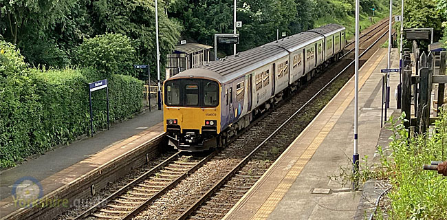 Station managed by: NORTHERN. Operator/s: NORTHERN.
  NATIONAL RAIL - Departure and station info
External link to National Rail live departure board for services at this station (opens in new tab).
Places to visit
 Worsbrough Mill
Worsbrough BridgeThis working 17th century flour mill uses water power from the River Dove at Worsbrough Bridge, 2.5 miles south of Barnsley town centre. Visitors can learn about the milling process and explore the surrounding country park, set around Worsbrough Reservoir. Admission is free, but there are charges in the car park. The mill is off the A61 at Worsbrough Bridge. Buses from Barnsley, including 66 and 265, stop nearby. The mill is run by Barnsley Metropolitan District Council.
Find out more on the
 Worsborough Mill
 Monk Bretton Priory
Abbey Lane, Cundy CrossThe ruins of Monk Bretton Priory, a monastery originating in 1154, can be found at Abbey Lane, Cundy Cross, two miles east of
More information at the
English Heritage - Monk Bretton Priory Find Monk Bretton Priory on map
 Cannon Hall
Bark House Lane, CawthorneVisitors can explore the Georgian country house museum and gardens and parkland, extending across 28 hectares (70 acres). The hall also stages a wide range of events from art exhibitions to baking days and re-enactment events. Cannon Hall is 6 miles by road west-north-west of Barnsley town centre just off the A635 road near the village of Cawthorne. It has a large pay and display car park. Bus 92 connects Barnsley to Cawthorne village with a walk of about a mile to Cannon Hall. On Sundays three 92A services run to Cannon Hall.
More information at these
Cannon Hall Cannon Hall Farm
Bark House Lane, CawthorneCannon Hall Farm is an award-winning open farm attraction just up the road from the hall itself. The farm has grown to become one of the largest such attractions in the country, now including adventure playgrounds, a gift shop, farm shop and restaurants. The animals themselves are the main appeal though, with a rare breeds barn and milking demonstrations. There are car parking and admission charges, though parking is free and admission reduced after 3.30pm, follow the link to the farm website for details. The farm is also host to the Underneath The Stars Festival of art, music, food and drink in July. Bus 92 connects Barnsley to Cawthorne village, a walk of about a mile to Cannon Hall Farm. On Sundays three 92A services run to Cannon Hall.
More information at the
Cannon Hall Farm Elsecar Heritage Centre
Wath Road, ElsecarThe heritage centre is located in a former ironworks and colliery workshops and houses an antique centre, craft workshops and exhibitions of the past history of the conservation village of Elsecar. Key attractions include the 1795 Newcomen Beam Engine, the only one of its kind to have been preserved in its original location. The Elsecar Heritage Railway previously operated mainly at weekends along a restored part of a branch line which served collieries and iron works, but faced closure in 2020. The centre stages a series of events, including children's activities, car shows and auctions. The Heritage Centre is 6 miles south-south-east of Barnsley. It can be reached from Barnsley by bus on route 66 or by train to Elsecar station, from where it is a walk of about half a mile.
Find out more at the
Elsecar Heritage Centre Wentworth Castle Gardens
The Grade I listed gardens and parkland of Wentworth Castle, a country house at Stainborough, near Barnsley, were reopened in 2019 by the National Trust in partnership with Barnsley Council and Northern College, which occupies the house, which is closed to visitors.
The gardens, like the house itself, are largely the result of family rivalry in the 18th century with the inheriters of Wentworth Woodhouse, a spectacular country house around six miles away. Miles of parkland include various monuments and also Stainborough Castle, a folly ruined castle of medieval appearance which continues the name of an earlier house at Wentworth Castle. A Union Jack Garden commemorates the union of England and Scotland in 1707 and there is also a Victorian conservatory.
For more information see the
National Trust - Wentworth Castle GardensLocate on map:
Wentworth Castle Gardens Wortley Top Forge
Forge Lane, Thurgoland
Wortley Top Forge was a heavy iron forge powered by water which traces its history back to at least 1640. It is situated in the secluded wooded valley of the River Don just over half-a-mile south-south-east of the village of For more details see the Wortley Top Forge website.
Wortley Top Forge Find on map: Wortley Top Forge
Wortley Top Forge Yorkshire Sculpture Park
West Bretton
The Yorkshire Sculpture Park is the UK's leading open-air sculpture gallery, situated at More information at the Yorkshire Sculpture Park website.
Yorkshire Sculpture Park Find on map: Yorkshire Sculpture Park
Yorkshire Sculpture Park National Coal Mining Museum for England
The National Coal Mining Museum for England is mid-way between
More details at the
National Coal Mining Museum Peak District National Park
The vast area of the Peak District National Park starts around 10 miles to the west of Barnsley town centre, stretching from Yorkshire into Derbyshire and beyond. For more details see our  Emergency services
South Yorkshire Police South Yorkshire PoliceSouth Yorkshire Fire and Rescue
South Yorkshire Fire and RescueYorkshire Ambulance Service NHS Trust
Yorkshire Ambulance Service NHS Trust Local government
Metropolitan district council
Barnsley is one of four metropolitan district authorities within the county of South Yorkshire.
It covers Barnsley and dozens of other towns, villages and hamlets, stretching for around 20 miles east to west and around 10 miles north to south. The western part of the borough includes an area of the
Barnsley council's 63 councillors serve three per ward across 13 wards for a four-year term. An election of one councillor per ward takes place each year with no election in the fourth year.
Link to Barnsley MBC website.
Barnsley MBCPolitical composition after May 2024 election is:
63 members
County strategic authority
South Yorkshire Mayoral Combined AuthorityCovers combined services including public transport, housing, infrastructure and regeneration and adult education in
 Barnsley
 Doncaster
 Rotherham
 Sheffield
Elected mayor:
South Yorkshire Mayoral Combined AuthorityPolice and Crime Commissioner
This role becomes the responsibility of the elected South Yorkshire mayor after the May 2024 election. South Yorkshire Police and Crime CommissionerFire Authority
South Yorkshire Fire and Rescue AuthorityThe fire authority is made up of elected members of each of the four metropolitan district councils of South Yorkshire - Barnsley, Doncaster, Rotherham and Sheffield.
South Yorkshire Fire and Rescue AuthorityParliamentary constituency
Barnsley SouthElected MP: